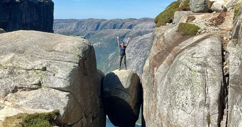
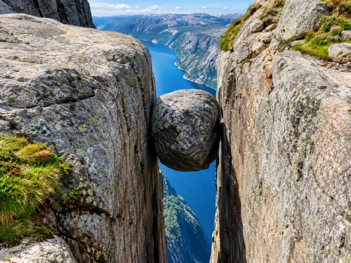
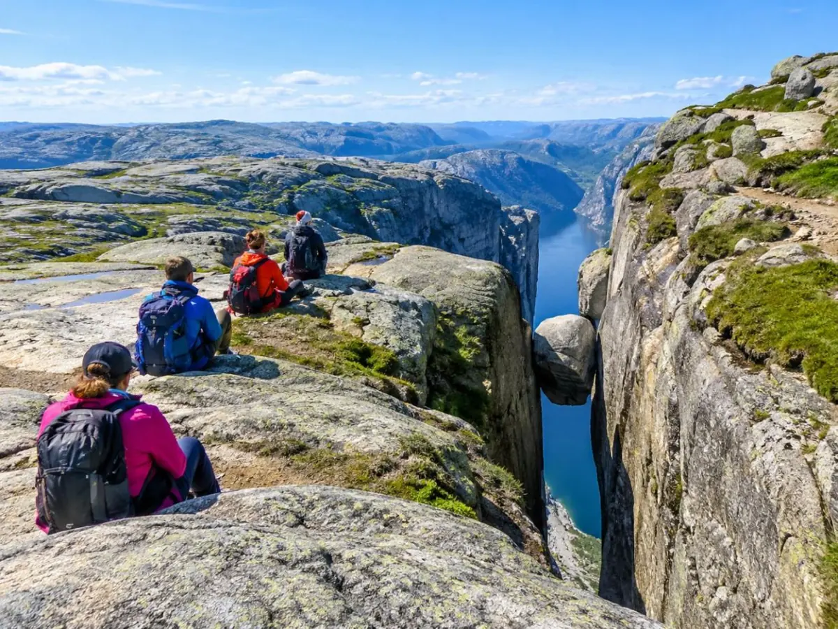
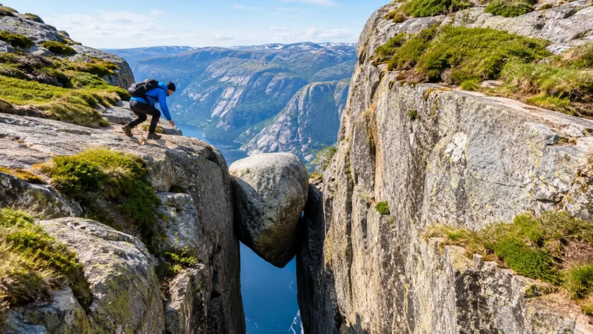
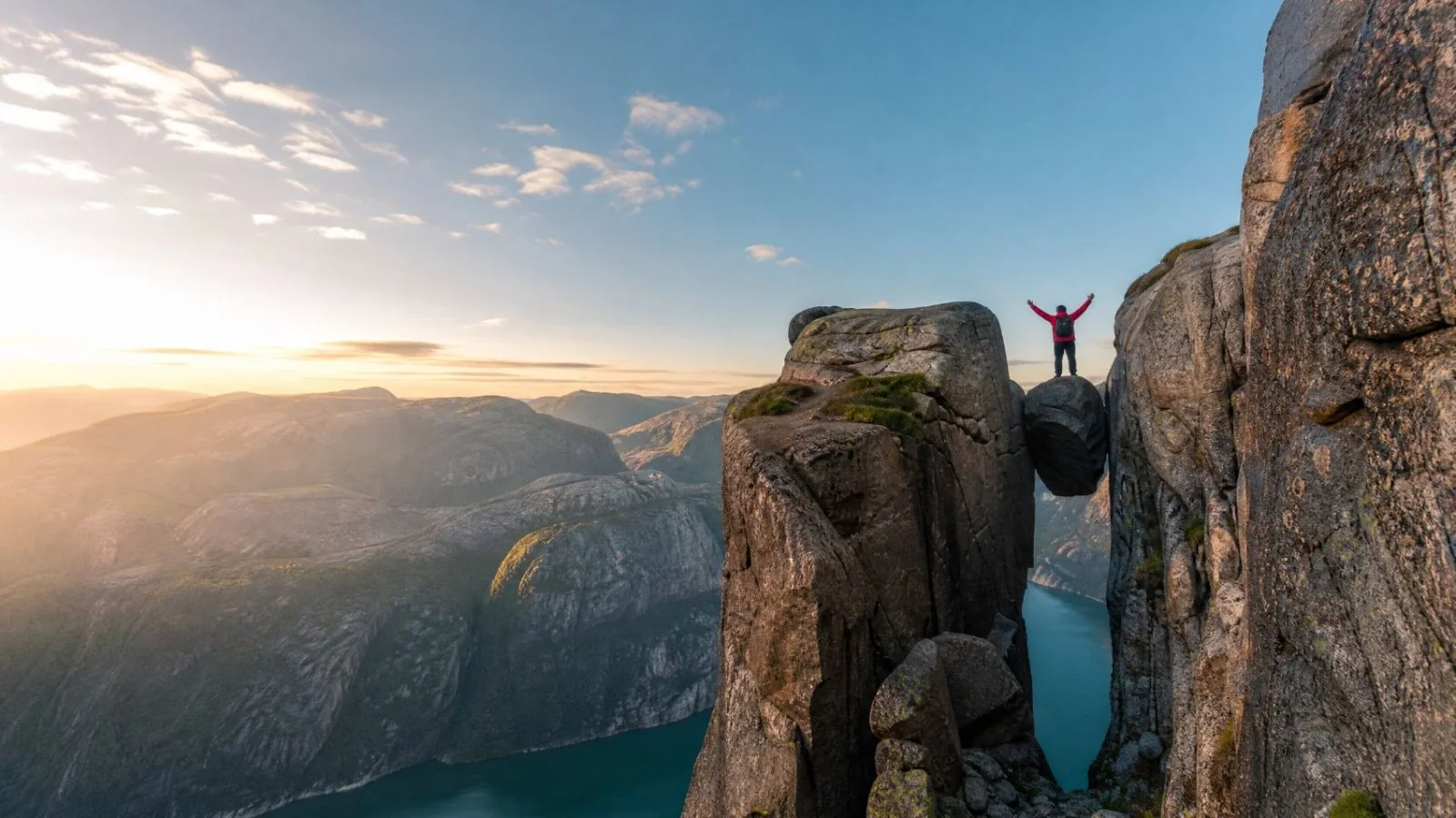
A boulder jammed in a crevice on Kjerag, 984 metres above Norway's Lysefjord.
Haul yourself up three granite ridges on chains, cross a plateau of pools and late snow, then step out with only the fjord beneath you.
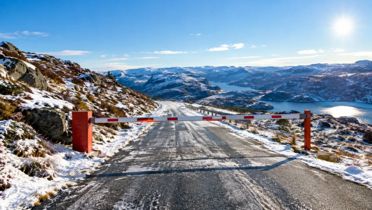
Autumn 2026: the mountain road to the Kjerag trailhead closes with the first snow, usually in October or November, and the trail chains come down with it. Without a guide, plan for June to September 2027. Fjord Norway: KjeragChecked October 2026
Safety firstWhat the ledge, the chains and the weather really ask of you
Every Kjerag tourAll three guided options side by side
Free cancellationUp to 24 hours before, on every tour here
No ticket neededThe hike is free; you pay for transport or a guide
Tours
Choose your Kjerag tour
Three guided ways to Kjeragbolten start in Stavanger. In the centre, the small-group day most hikers book. Either
side, a private guide at your own pace and a two-day trip that adds Pulpit Rock. Every card opens a full tour page.
Your own guide and car for the day, at your pace. Parking fees, a Norwegian snack at the top and, when needed, crampons are included. A small listing with few reviews yet.
What's included
Private guide who also drives
Pickup and drop-off at your Stavanger accommodation
A small-group day from Stavanger: van over the Lysevegen road, then about five and a half hours on the trail with a guide who knows where the chains and the safest step onto the boulder are.
Pulpit Rock and a fjord cruise on day one, a night in Lysebotn at the foot of the hairpins, then Kjerag fresh the next morning. A newer listing with few reviews yet.
What's included
Guided hikes to Preikestolen and Kjerag
Lysefjord sightseeing cruise
Night in Lysebotn with a two-course dinner and breakfast
Only three trips here actually reach Kjerag. The rest are good days on the same fjord, and the table says so
plainly, because several "Lysefjord" listings look like they go further than they do.
Every tour here cancels free up to 24 hours before. Going on your own, the hike costs nothing; you pay
for the car park at Øygardstøl or for the Kjerag Express bus.
Before you book
The boulder is free. Getting there is the trip.
Nobody sells a ticket to Kjeragbolten. The rock sits on open mountain in Sandnes municipality, and anyone may walk
to it. What costs time and money is everything around it: a drive of two and a half to three hours from Stavanger,
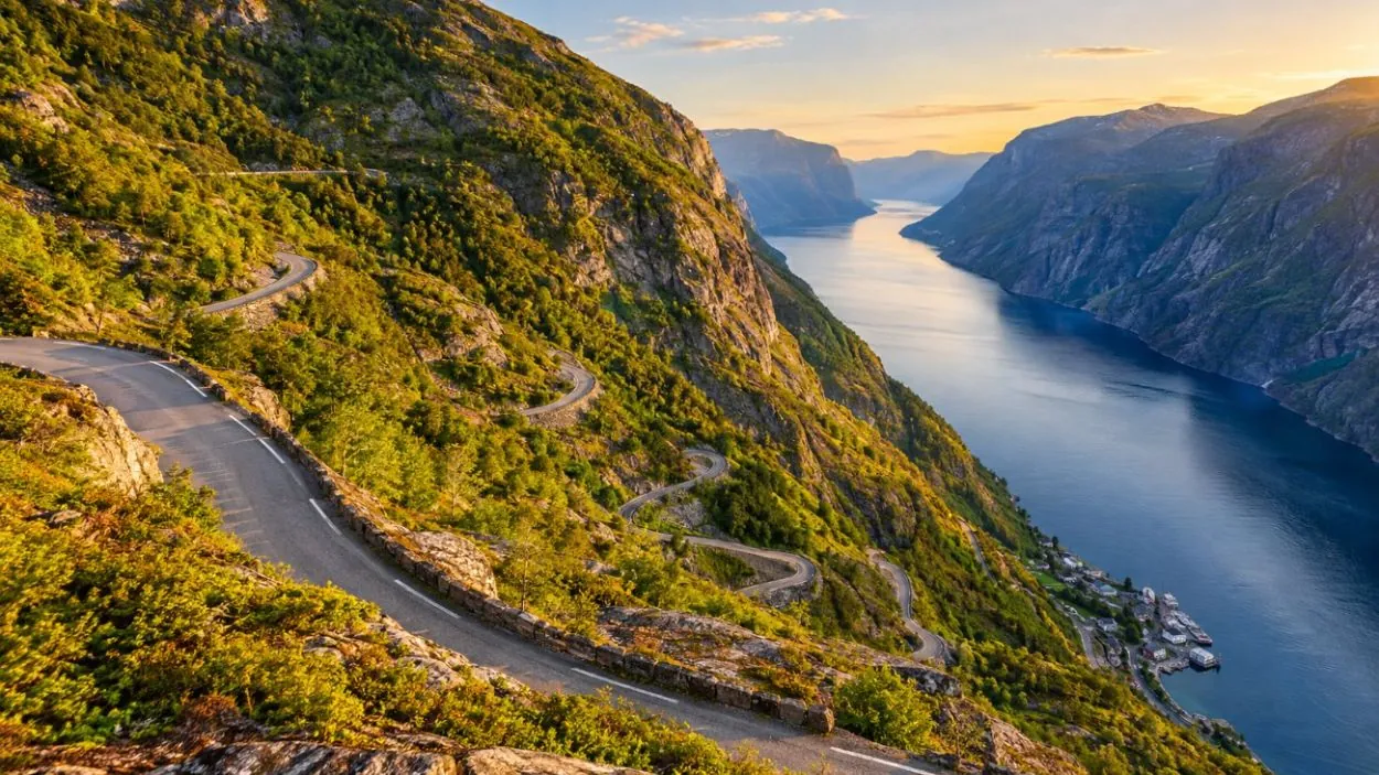
a mountain road with 27 hairpins that is shut for half the year, a fee car park at Øygardstøl, and then about
11 km of trail with three steep climbs, there and back.
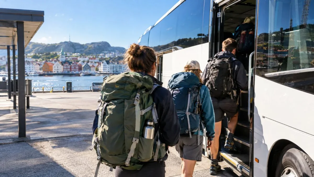
That is why most visitors without a car book a guided day from Stavanger. The guide drives, picks the
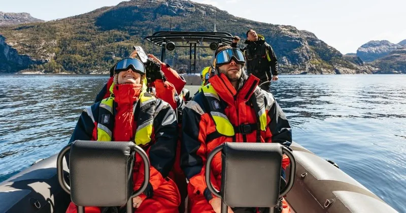
weather window, knows where the water is and walks you to the ledge. The Lysefjord cruises and RIB boats out of
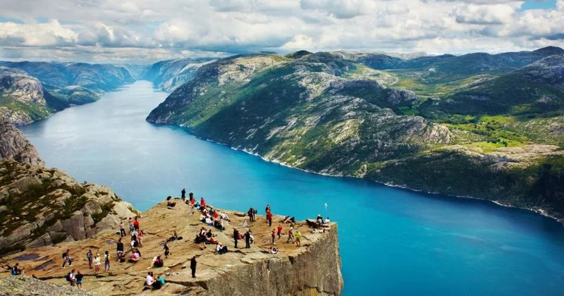
Stavanger are lovely, but every one of them turns around near Pulpit Rock and the Hengjanefossen waterfall. None of
them shows you Kjerag. Read the route, not the photo.
984
Metres between the boulder and the fjord. You step onto it from a
ledge about 30 cm wide, with no railing. Plenty of people stop at the edge and take the view from the plateau, and that is fine.
Guided dayPrivate guideTwo-day tripOn your own
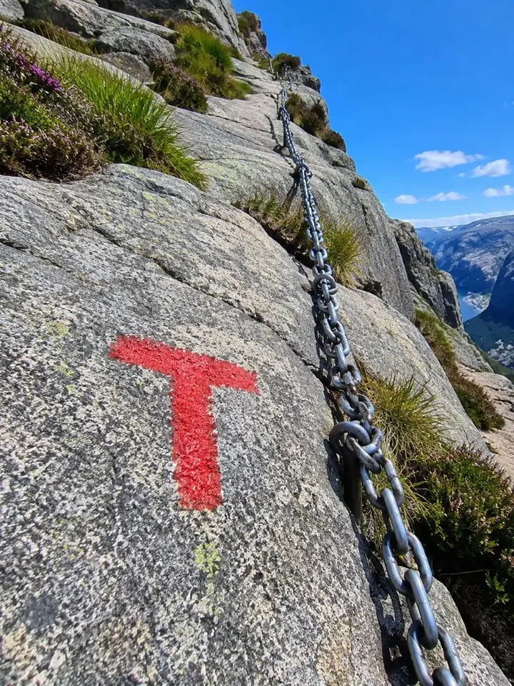
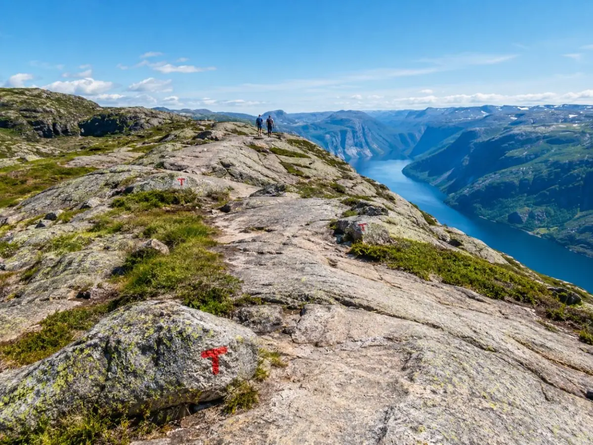
Follow the red T: the trail is waymarked on the rock, and chains cover the steepest slabs in summer.
01
How hard is it?
About 11 km and 6 hours, three steep climbs with chains. Fit hikers only.
02
When can I go?
June to September is the safe window. The road shuts with the first snow.
03
Do I need a guide?
Not in good summer weather. With snow, wind or no car, a guide makes sense.
04
Who should skip it?
Anyone with vertigo, a bad heart or knees, or low fitness. Every operator says so.
Your day
How a Kjerag day runs
Eleven to twelve hours from Stavanger and back on a guided day, about six of them on foot. This is the shape of it.
01
Early start
Pickup in Stavanger or Sandnes, then a long drive east through the mountains and up the Lysevegen road.
About 2.5 hours
02
Three climbs
From Øygardstøl the trail rises over three granite ridges, the steepest slabs on fixed chains, with valleys in between.
2.5 to 3 hours up
03
The boulder
Across the plateau to the crevice. Queue, then step onto the rock, or watch and take the view from the edge.
30 to 60 minutes
04
Back the same way
The same three ridges in reverse, which is harder on the knees than the climb was on the lungs.
Season, what each option includes, fitness and what to pack: one tab each.
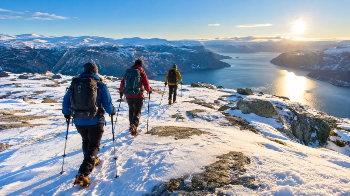
Mid-May to early June: the road usually reopens, but snow often still lies on the plateau. Go with a guide.
June to September: the main season, chains in place, the Kjerag Express bus running on set days.
July and August: the longest days and the longest queues at the boulder. Start early.
October: shorter days, colder rock and the first snow. Check the road before you set off.
November to mid-May: the road to Øygardstøl is normally closed and the chains are taken down.
Small-group guided day: van from Stavanger or Sandnes, a guide on the trail, max 8 hikers.
Private guide: your own guide and electric car, parking fees, a summit snack and crampons when needed.
Two days: Preikestolen, a fjord cruise, a night in Lysebotn with dinner and breakfast, then Kjerag.
On your own: the hike is free; you pay for the Øygardstøl car park or the Kjerag Express bus.
Live prices for your date are on each listing; every tour here cancels free up to 24 hours before.
About 11 km round trip and roughly 750 m of total ascent, in three separate climbs each way.
Several hundred metres of fixed chains on bare granite; you use your hands.
Operators rule out vertigo, fear of heights, low fitness and pregnancy; the private tour sets a minimum age of 10.
If you have never hiked six hours on rock, try Preikestolen first.
Broken-in hiking boots with good grip. Trainers slide on wet granite.
Windproof and waterproof layers, a warm mid-layer and a hat, even in July.
Gloves for the chains, a headlamp, and food for the whole day.
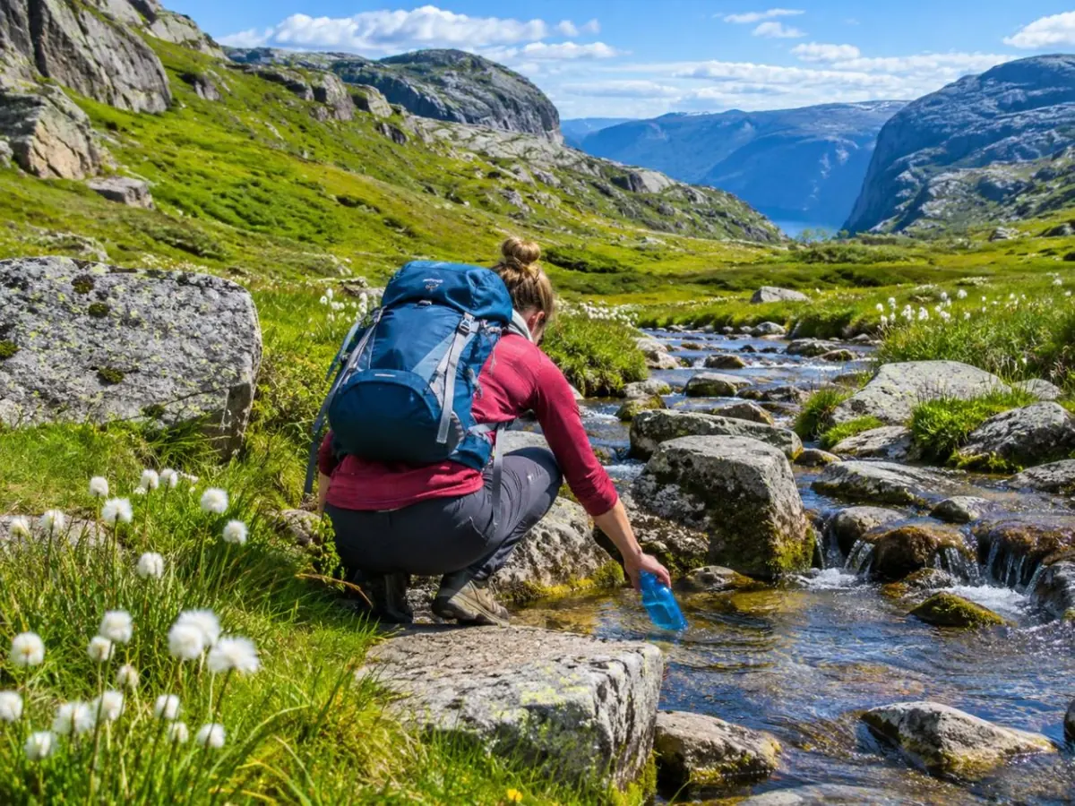
Water: refill at the stream in Storedalen, but carry 1 to 2 litres anyway. Full list in the difficulty guide.
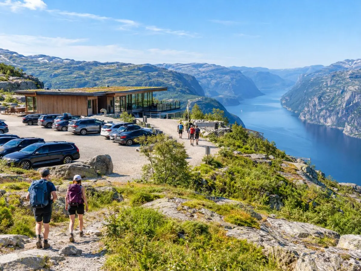
TrailheadØygardstølFee car park with toilets and a staffed tourist information centre from May to October.
DistanceAbout 11 kmThere and back on the same marked trail, red T on the rock.
TimeAbout 6 hoursFjord Tours says 6 to 10 hours, depending on fitness.
AscentAbout 750 mCumulative, over three ridges each way.
Drop984 metresFrom the boulder to the water of the Lysefjord.
Refund24 hoursFree cancellation up to a day before, on every tour here.
Where it is
Where to find Kjeragbolten
At the inner end of the Lysefjord
Trailhead: Øygardstøl car park, on the Lysevegen road above Lysebotn
Kjerag rises on the south side of the Lysefjord, just southwest of the village of Lysebotn, at the far end of the
fjord from Stavanger. The trail starts at Øygardstøl, a car park and service building on the road that climbs out of
Lysebotn in 27 hairpins. Guided tours collect you in Stavanger or Sandnes and drive you there.
By car from Stavanger: 2.5 to 3 hours
Kjerag Express bus: 07:45 from Stavanger, 16:30 back
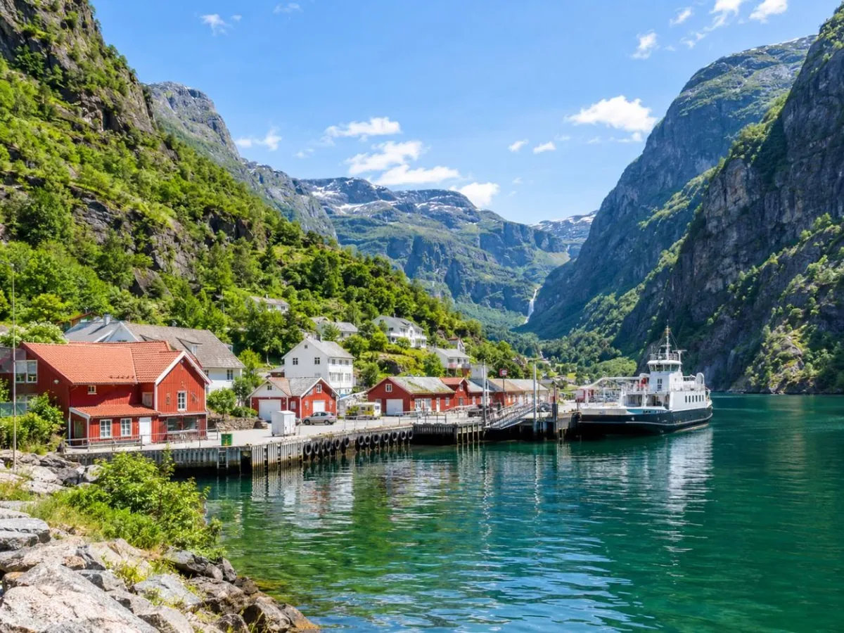
By ferry: to Lysebotn, then a shuttle up the hairpins
A rest day after Kjerag. The electric catamaran runs out of Stavanger to the Hengjanefossen waterfall and Pulpit Rock from below, with an audio guide. It does not go as far as Kjerag, so book it for the views of the outer fjord, not the boulder.
The photo is always the same: one person on a round rock in a crack, a long way above the water. The day
behind the photo is what you are signing up for.
What the boulder is
Kjeragbolten is a lump of rock of about five cubic metres, wedged in a crevice on the north face of Kjerag. It was
dropped there by ice during the last glaciation and has been stuck ever since. Under it is a drop of 984 metres to the
Lysefjord. The mountain itself tops out at 1,132 metres, the highest point on the fjord, and its north face is a magnet for
BASE jumpers: 48,668 registered jumps between the first one in 1994 and 2016.
"Bolten" means "the bolt", which is where the English nickname, the Kjerag Bolt, comes from. Norwegians say it
roughly "SHEH-rahg-bol-ten".
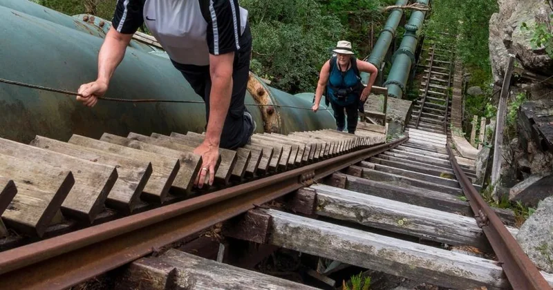
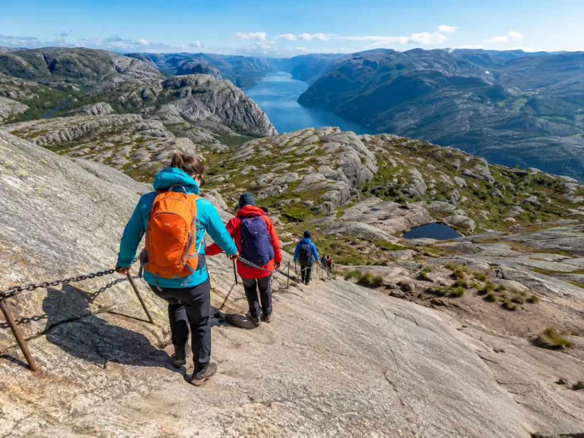
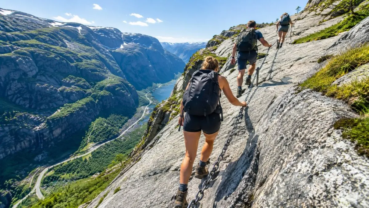
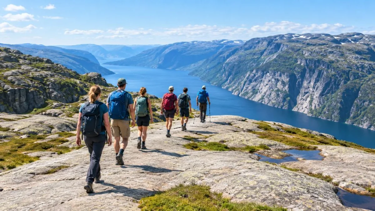
The first climb out of Øygardstøl is the steepest, with chains on the bare slabs.
The hike
From the car park at Øygardstøl the trail is about 11 km there and back, with roughly 750 metres of climbing in
total. It is not one long ascent. You climb a ridge, drop into a valley, climb again, drop again, and climb a third
time before the plateau, and then you do all of it in reverse. The steepest slabs have fixed chains, several hundred
metres of them, and you will use your hands. Fjord Norway rates it challenging. Allow about six hours, more if you are
slow on rock or the queue is long.
There is water in Storedalen, the valley before the last climb, and nothing else on the way: no hut, no kiosk, no
toilet after the car park. The trail is marked with a red T on the rock, and in cloud you will want to see the next one
before you leave the last.
The honest small print: stepping onto the boulder is the easy part to skip and the hard part to
do safely. The ledge is about 30 cm wide, there is no railing, and wet rock changes everything. Many hikers watch, take
the plateau view and walk home happy. Our safety guide covers how to decide on the day.
Getting there
This is the part that catches people out. Kjerag sits at the inner end of the Lysefjord, and the road up from
Lysebotn to the trailhead, with its 27 hairpins, closes with the first snow and usually reopens in mid-May. From
Stavanger it is 2.5 to 3 hours by car each way. Without a car you have the Go Fjords Kjerag Express bus on set summer
days, a ferry to Lysebotn plus a shuttle, or a guided tour that does the driving. The
transport guide sets them side by side.
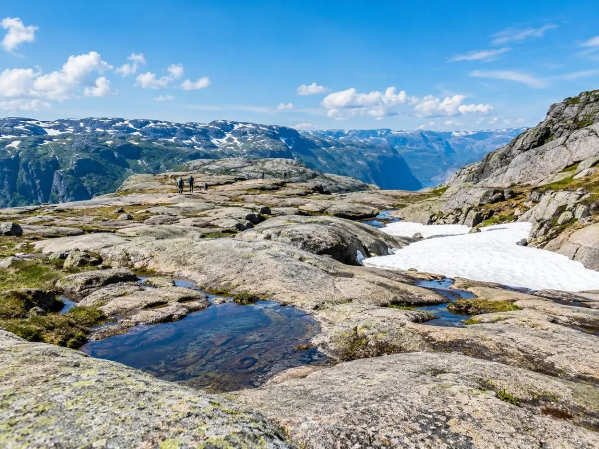
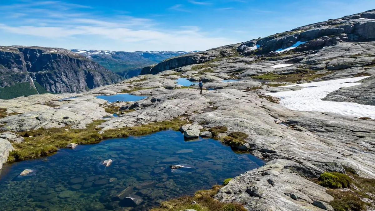
The plateau before the boulder: bare granite, pools and, into early summer, old snow.
Guide or no guide?
In dry summer weather, with a car and decent fitness, plenty of people hike Kjerag on their own. A guide earns the
money in four situations: you have no car, there is still snow on the plateau, the forecast is marginal, or you are
nervous about the chains and the ledge. Reviews of the guided day keep coming back to the same thing: the guide made
them feel safe. The tour comparison goes through the three options.
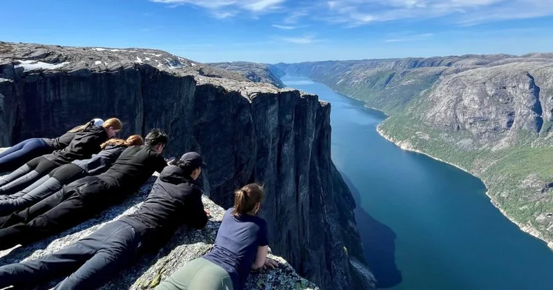
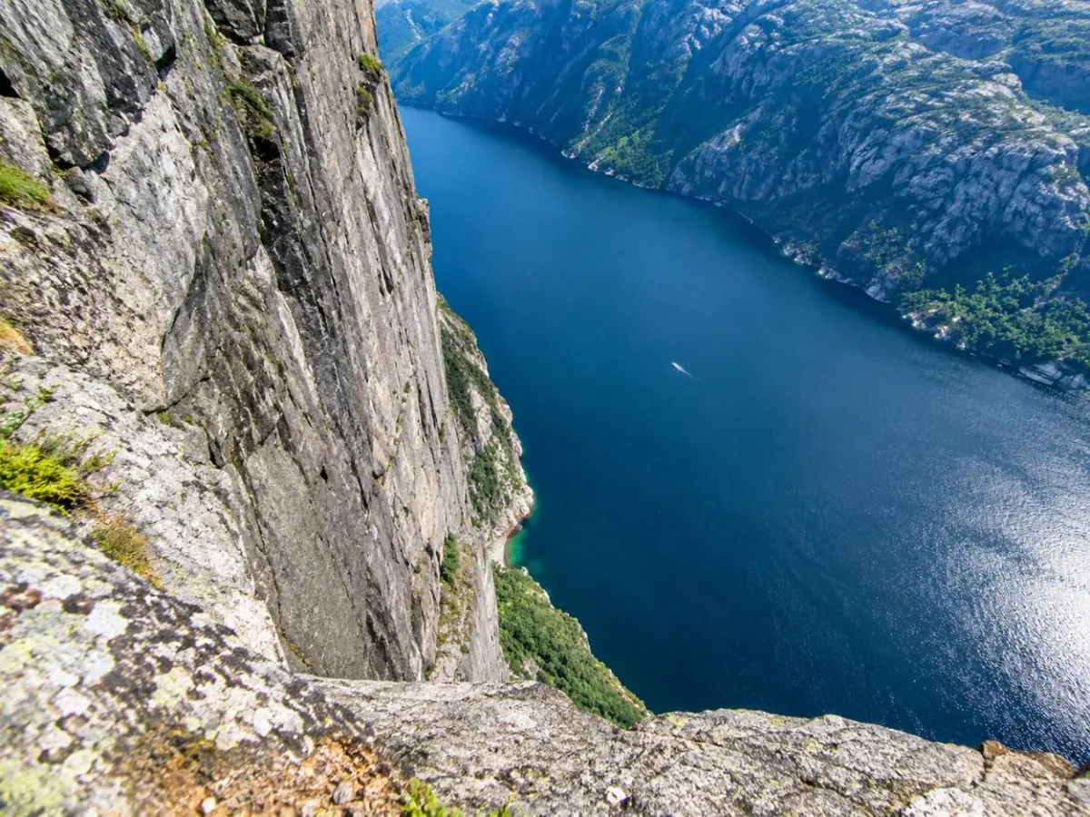
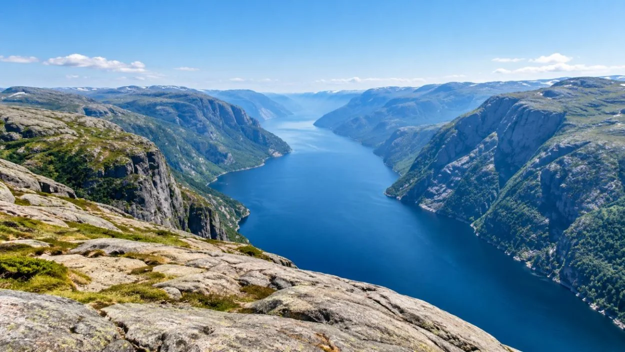
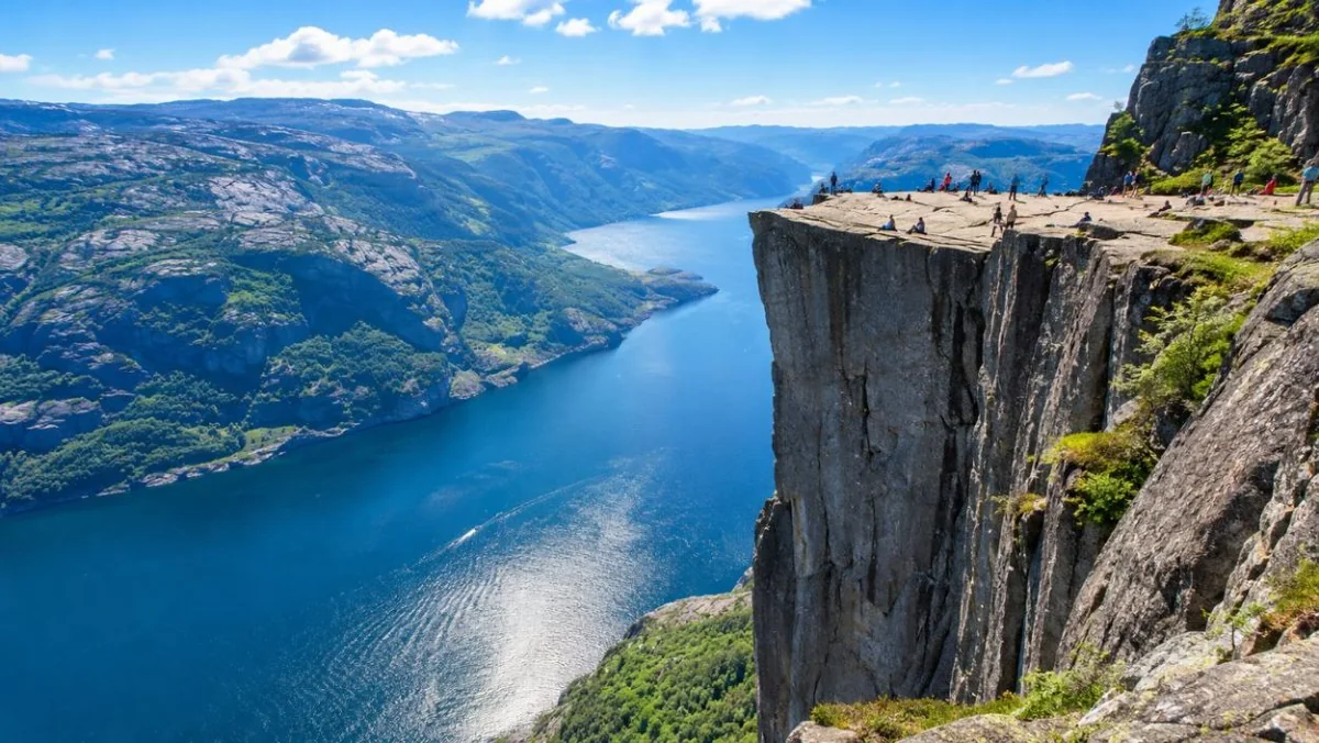
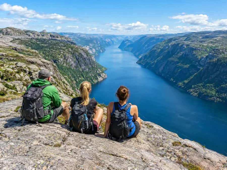
From the edge of the plateau the Lysefjord lies almost straight below.
Straight answers to what people ask most about Kjerag and the boulder.
Is the Kjerag hike difficult?
Yes, for most people it is the hardest day hike they do in Norway. It is about 11 km there and back with three steep climbs over bare granite, several hundred metres of fixed chains, and about 750 metres of ascent in total. It is not technical climbing, but you need good fitness and grippy boots. The full picture is in how hard the Kjerag hike is.
How long does it take to hike to Kjeragbolten?
Plan on about 6 hours for the round trip from the Øygardstøl car park, more with a long wait at the boulder or in wet weather. Fjord Tours gives 6 to 10 hours depending on fitness. Add 2.5 to 3 hours each way from Stavanger by road.
Is it safe to stand on Kjeragbolten?
The boulder itself is jammed tight and does not move. The risk is the step onto it: a ledge about 30 cm wide, no railing, and a drop of 984 metres. No death from falling off the boulder is on record, as far as published sources show, but wet rock and wind change everything. Skip the step if your legs shake. Read is Kjeragbolten safe before you go.
Has anyone ever fallen from Kjeragbolten?
There is no recorded death from a fall off the boulder itself. The deaths at Kjerag are mostly BASE jumpers: NRK counted 11 fatal BASE accidents between the first registered jump in 1994 and 2016. That is a different activity from the hike.
When can you hike Kjerag?
Roughly June to September. Fjord Norway gives May to October, but the mountain road to the trailhead is usually shut from the first snow (October or November) until about mid-May, and snow often lies on the trail into June. Outside the season, only go with a guide. See the best time to hike Kjerag.
How do I get to Kjerag from Stavanger?
Drive about 2.5 to 3 hours to the Øygardstøl car park, take the Go Fjords Kjerag Express bus (07:45 from Stavanger, back at 16:30, on set summer days), or take a ferry to Lysebotn and a shuttle up the hairpins. A guided tour includes the transport. All four options are in how to get to Kjerag.
Is Kjeragbolten worth it?
If you are fit and comfortable near drops, yes: few day hikes end on anything like it, and the view down the Lysefjord from the plateau is worth the trip even if you never step on the boulder. If heights make you freeze, Preikestolen is the gentler choice on the same fjord.
Kjerag or Preikestolen: which is harder?
Kjerag, clearly. Preikestolen is about 8 km with around 500 metres of climbing on a built path; Kjerag is about 11 km with three chain-assisted climbs and a longer drive. Compare them in Kjerag vs Preikestolen.
How do you pronounce Kjeragbolten?
Roughly "SHEH-rahg-bol-ten". The Norwegian "kj" is a soft hiss, close to the "ch" in German "ich", and "bolten" means "the bolt", which is how the boulder got its English nickname, the Kjerag Bolt.
Do you need a ticket or a guide for Kjerag?
No ticket: the hike is free. You pay for the car park at Øygardstøl or for the bus. A guide is optional in summer and strongly advised with snow on the trail. Our tour comparison sets the guided options against going alone.
Can I cancel a Kjerag tour?
Every tour on this site cancels for a full refund up to 24 hours before the start. Guides also call off or reroute a hike in storms or heavy rain, and then offer a refund or a new date.
Ready to book
Pick your day, then pick your step.
Transport and a guide from Stavanger, and free cancellation up to 24 hours before on every tour.

 Private
★ 5.012 hoursFree cancellation